Pacific Rim
Trying to make sense of how the US Coast Guard and the Chinese Navy went toe to toe off Alaska
In today’s post, we discuss:
The Chinese naval flotilla that enjoyed a late summer vacation off the coast of Alaska
Satellite imagery that appears to show part of the flotilla, as well as its US Coast Guard (and possibly US Navy?) escorts
What the Coast Guard cutters were up to after their escort mission
You’ll notice that this blog post, for the first time, includes a short summary at the top. The summary is a frankly genius suggestion from a reader who submitted the idea in the survey (which is still open, if you’d like to take it!). I’ll try to include these in the future for folks who may not have the time to read the full post but still want to get the highlights. Also, major thanks to Alexander Haynes for helping with the research and shipspotting for this post. Go read his stuff over at osinteditor.com!
The Aleutians are a chain of several hundred volcanic islands that run like a string of pearls from the Alaskan mainland to the Russian coast. They’re craggy, remote, and incredibly strategic. Japanese forces invaded the islands during World War II and the US conducted nuclear weapons testing there throughout the Cold War. Nowadays, their importance lies primarily in their (relative) proximity to China, Japan, Russia, and the enormous US naval base in Pearl Harbor, Hawaii.
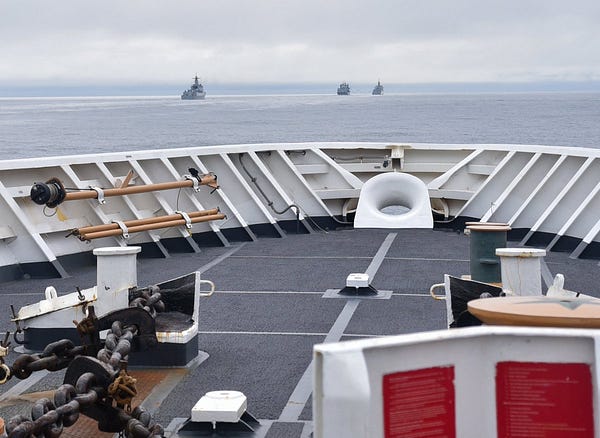
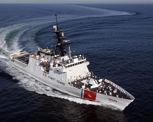
In late August, China sent to the islands a small fleet of naval vessels which, according to the US military, were shadowed by a pair of Coast Guard cutters and an icebreaker1. Before they got to Alaska, they passed eastbound from the Sea of Japan through the Soya Strait (which Japan was not thrilled about) before evidently arriving off the Aleutians around August 29. As always, I wanted to know more. If you’ve read this blog for a while, you know where this is going…


Since the military said the ships were shadowed on August 29 and 30, Alex and I fired up Sentinel Hub to see if we could find any imagery of the islands on those days. No luck on August 29, but a Sentinel-1 satellite passed directly over the middle and eastern sections of the island chain on August 30.2
The images that day, consisting of a southwest image and a northeast image close to the Aleutian island of Unalaska, are packed with interesting details.

First up are the interference swaths. I’ve discussed these in blog posts before3, but here’s a quick overview. Sentinel-1 satellites use radar, rather than visible light, to compose images of the earth below. Up in space, the satellites’ radar beams are fired off with a frequency in the C-band of the electromagnetic spectrum (4 to 8 GHz). Problem is, certain powerful radars back on earth, including those found on navy ships, also operate in the C-band. When a C-band radar on earth or in the ocean is active, it will create a noticeable scar across the image perpendicular to the Sentinel-1 satellite’s direction of travel. Typically, the device that caused the scar is located underneath or extremely close to the scar itself.
In the images above, there is not one but two interference swaths seen out in the ocean, indicating that at least two military vessels’4 C-band radars were active at the time of the image.
It’s Conjecture Time
In the southwest image, one scar is adjacent to the edge of the image. Zooming in, a ship, almost certainly carrying the radar causing the interference, is visible directly underneath the band.
The issue is that, according to Sentinel Hub’s measurement feature, the ship is over 200 meters long - far longer than any of the Coast Guard or Chinese ships.
The longest vessel on scene, the Chinese Navy’s replenishment vessel Kekexilihu, is only about 179 meters long.
Despite that setback, I still think what we’re seeing under that interference swath is the Kekexilihu. There are a few reasons for this. First, satellite radar images tend to reflect brighter off sharp corners on the earth below. Bridges, skyscrapers, construction equipment, and other large, rectangular objects all appear as bright crosses under this type of imagery. Know what else has a lot of right angles?
That’s right - the Kekexilihu. Unlike the sleeker frigates and destroyers in modern navies, naval supply ships are built much more like their merchant counterparts, with lots of hard surfaces, right angles, cranes, hoists, antennae, prominent bridges, and other surfaces that make radar imagery light up like the Fourth of July.

These bright crosses can make an object appear significantly larger or differently shaped than it actually is (as this paper explains). Our guess - and it is just a guess, so reach out if you feel differently - is that we’re seeing this distortion in the southwest SAR image and the larger-than-life blip under the interference swath is actually the Kekexilihu.
The other option is that the satellite caught the Kekexilihu as it refueled another vessel, which means there are actually two vessels in the Sentinel imagery rather than one. There’s some evidence for this as well.
In the below image, taken on the same day as the satellite images, three Chinese vessels are being trailed by a Coast Guard cutter. The two Chinese ships at the front of the convoy are conducting a refueling at sea, with the third vessel and the Coast Guard ship several kilometers behind. Since the refueling ships are so close together, they may appear as a single vessel to the relatively low-resolution satellite.
It also makes sense that the satellite image’s interference scar comes from a destroyer rather than the Kekexilihu supply ship, which ostensibly has less need for a powerful C-band radar than a major surface combatant like a destroyer.
Lastly, the Coast Guard said the Chinese ships came within 46 miles (74ish kilometers) of Alaska:
During the deployment, Bertholf and Kimball observed four ships from the People’s Liberation Army Navy (PLAN) operating as close as 46 miles off the Aleutian Island coast.
As it turns out, the ship(s) under the interference swath are almost exactly that distance from the Alaskan coast.
Now that I’ve sufficiently bored you with details about the southwest image, let’s check out the northeast image.
There’s also an interference swath in that image and, sure enough, just west of the scar is a little blip. That blip, however, is exactly the length of a US Navy Arleigh Burke-class destroyer. (Note that both the Arleigh Burkes and the Coast Guard cutters carry C-band radar capable of making the interference swath seen in the image)
Now that’s odd - neither the Coast Guard nor the Chinese government said the US Navy was involved. Of course, as I mentioned above, radar imagery is weird - sometimes objects are distorted and things are not always as they seem. It’s possible that the blip is just a highly distorted cutter. However, the similarities in length between an Arleigh Burke and that blip are too strong to dismiss out of hand, especially considering the Navy would probably like to keep an eye on the Chinese vessels as much as the Coast Guard would.
For what it’s worth, we do know that blip in the northeast image is not a Chinese vessel, since it’s well within US territorial waters, unlike the blip(s) in the southwest image.
So what happened since then?
After seeing off the Chinese ships back the way they came, a Sentinel-1 satellite again caught the icebreaker USCGC Healy and the cutter USCGC Kimball hanging out near each other just south of the Aleutians on September 3.
The length of the ship on the right matches with the length of the Kimball and the ship on the left displays the crosses indicative of the many right angles on the chunky icebreaker:
The other cutter, USCGC Bertholf, had likely already headed back to Japan (perhaps in the company of the Chinese flotilla), since it appeared off the coast of Yokohama on September 6, and it takes longer than three days to sail the 2800 miles from Alaska to Japan5:
For their part, the Chinese ships returned to China by way of southern Japan on September 11 and presumably arrived at their bases shortly thereafter.
Though much of the Chinese flotilla’s Aleutian adventure remains a black box, the power of satellite imagery and open-source information is able to reveal the locations of the ships on at least August 29 and 30, when they were closest to the US.
In case, I suppose, China tried to deploy some Tactical Ice.
A Sentinel-2 satellite, which uses visual imagery rather than radar, also passed over the Aleutians that day, but its images are pretty much useless because it was extremely cloudy.
Merchant and private vessels, on the other hand, have no need for such powerful radars.
This was bothering me, so I did the math. Accounting for time difference, there was about 71 hours between the 9/3 sat image and Bertholf arriving off Japan on 9/6. Travel distance between Unalaska and Yokosuka is ~2400 nautical miles. Even traveling at its top speed of 28 knots, Bertholf would only make it ~2000 nautical miles in 71 hours. Ipso facto Bertholf cannot appear in the 9/3 sat image.


