Shelling in Ukraine Briefly Caused Europe's Worst Air Pollution
And other environmental consequences from Russia's invasion of Ukraine
Highlights from today’s post:
Using Google Earth Engine to visualize conflict-driven pollution over eastern Ukraine
How vegetation health dropped precipitously due to the conflict in Ukraine
In an abstract sense, we know that the war in Ukraine is destructive. Just compare fire detections from NASA’s FIRMS system from 2021 to 2022 over eastern Ukraine.

Literally orders of magnitude more fires were detected this year in comparison to last year. Most of those fires weren’t your run-of-the-mill grass fires or crop burning either — they were instead caused by the artillery and gunfire endemic to Russia’s war in Ukraine. But what happens to the environment when that sheer quantity of ordnance pounds the farmlands and forests of eastern Ukraine?
In short (and in addition to the enormous attendant human misery), pollution goes up and vegetation health goes down.
During one particularly intense period of fighting, shelling targeting dense forests west of the city of Sievierodonetsk caused the biggest carbon monoxide plume in Europe at the time.
Mean tropospheric carbon monoxide1 levels over a five day stretch in early May were far higher near Sievierodonetsk than in any other location in Europe. And while it may not look like much, the red and yellow jet over eastern Ukraine represents a 130-kilometer swath of emissions whose northern tendrils reach halfway to Moscow.
The story is similar, though not as pronounced, for nitrogen dioxide2. While shelling still caused a clear plume of nitrogen dioxide in eastern Ukraine, there are other, similar plumes from around the country, perhaps caused by heavy industry, power plants, or non-conflict fires.
Either way, satellite images from that time show a region wreathed in smoke.

The dense smoke from the shelling (and the resulting pollution in the form of carbon monoxide and nitrogen dioxide) also likely lingered over the region for longer than normal due to sunny, still weather with little wind to dissipate it.
But that’s only part of the story.
So what about farms?
Shelling in eastern Ukraine doesn’t only target thick forests. Plenty of shells strike agricultural land, causing significant damage to farms and crop yields.
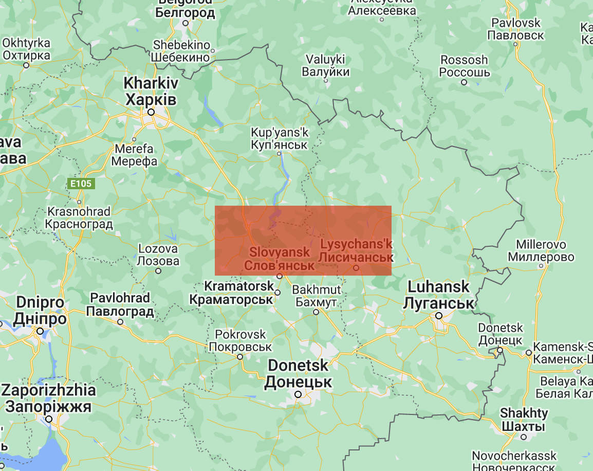
I measured NDVI (Normalized Difference Vegetation Index ) values for a rectangular area of interest centered over the farmland north of Slovyansk and Lysychans’k.
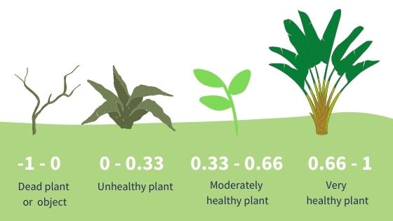
NDVI is a common satellite measurement of vegetation health. It is measured on a -1.0 to 1.0 scale, with very low values corresponding to rock, water, or snow and very high values corresponding to dense, healthy vegetation and crops.

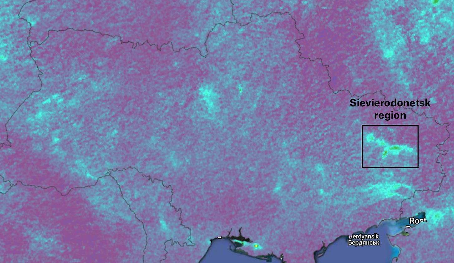
Within the area of interest, March to July NDVI values dropped from 0.36 in 2021 to 0.30 over the same period in 2022. Visualizations from Google Earth Engine show a dramatic change in the area’s farmland.
Unlike with the plumes of pollution, it’s difficult to pinpoint a single true cause of this drop in NDVI values, though we can make some educated guesses.
Most obviously, if shells blast craters into farmland or tanks drive across growing crops…that’ll kill those plants. The danger to farmers is clear as well, especially in a conflict like this one, where so much of the fighting consists of artillery duels across rural frontlines. If farmers are worried about being killed while they tend their crops, they’ll stay home, let fields lie fallow, or even flee their farms for safer areas.
Finally, there are the environmental factors to consider. Farming requires a great deal of energy and water for irrigation, preparing crops, fueling farm equipment, and so on. If the war causes the supply chains for those resources to break down (by, say, a pipeline being destroyed or a substation going out of service), then the farms that rely on those resources simply won’t be able to grow as much.
Any way you cut it, this war, like so many others, has been devastating for the environment.
Before signing off today, I want to say a massive thanks to Priya Patel of Earthbound for bouncing some ideas around, helping with research, and coming up with pollution measurements to look into.
According to Google Earth Engine, carbon monoxide is caused by the “combustion of fossil fuels, biomass burning, and atmospheric oxidation of methane and other hydrocarbons”
Once again, GEE explains that nitrogen dioxide is produced as a “result of anthropogenic activities (notably fossil fuel combustion and biomass burning) and natural processes (wildfires, lightning, and microbiological processes in soils).”


