Mr. DeBlasio, Tear Down These Sheds
Satellite imagery and public data reveal dozens of improperly permitted sidewalk sheds in New York City
Today’s post includes:
More information than you’ll ever need on New York City’s runaway scaffolding problem
Lots of public permit data and satellite imagery
How all of the above can detect non-compliant sidewalk sheds in the Big Apple
Satellite imagery can be used for lots of different things, from the thrilling to the downright mundane. For every Bellingcat piece uncovering a war crime or Planet Labs discovering a new arms race, there’s a Verisk using imagery for insurance underwriting or a FarmLogs using it for agriculture. Today’s post falls firmly into the latter category.
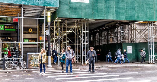
This is a sidewalk shed.
They’re as much a feature of New York City’s landscape as Paris’s cafes, London’s pubs, and Istanbul’s cats. A map of the city’s sidewalk sheds shows there are often over 9,0001 active at any given moment. They’re ugly, they’re ubiquitous, and most New Yorkers (myself extremely included) despise them.
The architect Bernard Rudofsky said that streets are for people, not cars or construction. Unfortunately, sidewalk sheds favor both cars and construction. By impeding pedestrians for the sake of building work, they promote vehicular traffic (which is rarely, if ever, disrupted by sidewalk sheds) and oppose everything that makes the city people-friendly: its walkability, ease of public transit, cultural attractions, architecture, proximity to bars and restaurants, etc.
Don’t get me wrong: if a building is at risk of collapsing or brickwork is teetering over the sidewalk like a concrete Sword of Damocles, I’m all in favor of sidewalk sheds2. What I’m not in favor of is negligent building owners keeping scaffolding up for years or even decades to avoid doing the more expensive but necessary repairs on their buildings.
Needless to say, when scaffolding went up outside my building last week, I was not psyched - especially when I found out that the average length of time these sheds stay up is almost a year. I was, however, psyched to see the absolutely enormous amount of public data New York City offers on construction permits (including scaffolding):
According to the NYC Building Code:
No sidewalk shed shall be installed without a permit in accordance with the requirements of Chapter 1 of Title 28 of the Administrative Code
With that code, the permit dataset, the truly ludicrous resolution of the city’s equally public orthoimagery3 and shapefiles of the city’s sidewalks, a devious plan began to take shape in my mind.
Let’s Get Technical
Could I overlay a map of New York City’s sidewalks, a map of sidewalk sheds in existence on a certain date, and satellite imagery from the same date in order to determine which sheds were too big, staying up too long, or otherwise non-compliant with local laws and regulations on the date the imagery was taken?
Absolutely!
It was actually relatively easy to download the city’s high-res imagery and import it into QGIS:
I initially tried to overlay a shapefile of the city’s sidewalks onto the imagery because I had grand ambitions of clipping the imagery to the bounds of the sidewalks. This would have made the image cleaner and the analysis a bit easier, but alas, my GDAL and Rasterio skills were not up to snuff. But if you think you can do it, please let me know!
After setting that aside, the next step was overlaying the locations of the sidewalk sheds in existence on May 2, 2018 (the last day on which aerial imagery of the city was taken) from the city’s permit data. This step was trickier but ultimately achievable with some basic Python.
Remember the three-million-line permit dataset I mentioned above? New York City offers an API endpoint to access that data, which I in turn accessed using Google Colaboratory. A buddy of mine introduced me to Colab few months ago and I’m already hooked. It’s incredibly easy to use, sets up in 30 seconds, and doesn’t require you to stress about dependencies, environments, or weird directory rules. This is now a firmly pro-Colab blog.
But enough shilling for Google. I connected to the API endpoint, asked it to return only results about sidewalk sheds, popped the results into a dataframe, filtered for May 2, 2018, and exported the results to a .csv file. Easy!

I loaded the .csv file into QGIS and voila, there were the locations of the sidewalk sheds, right where I expected them to be (e.g. outside the sidewalk shed on the north side of this block).
*to the tune of Uptown Girl* “Uptown sheds”
Now that I had the image and the permit locations established, the fun really began. I trawled through the imagery of my fair city to find sidewalk sheds that didn’t have red dots next to them - thereby indicating that a permit was not in force for that shed when the imagery was taken. There were dozens - perhaps hundreds - and it wasn’t long before I found one.
This Seventh Day Adventist Church at the corner of West 136th and Edgecombe either had a fire or started undergoing extensive repairs sometime in late 2012. Either way, a sidewalk shed went up around that time with all the correct documentation.
However, in 2017, the property owners started phoning it in. Sidewalk shed permits for the property lapsed in early 2018 and, though the permits went by the wayside, the scaffolding stayed. Scaffolding remains up outside the building as of September 2021 (albeit now with a nice tree growing through it):
In another example, the 300 block of West 147th Street has had wraparound scaffolding up since late 2013 or early 2014. The scaffolding is seen here in the 2018 aerial imagery of the city.
Google Streetview shows that particular shed is registered to 102 Bradhurst Avenue:
102 Bradhurst initially had the correct scaffolding permits, but it appears that they too gave up renewing the documentation since the last permits expired in March 2015.
It may not surprise you to learn that the entire block remains covered in scaffolding. For anyone keeping track at home, that’s almost eight full years of sidewalk sheds and about six and a half years of improperly permitted sidewalk sheds on that block.
Downtown Sheds
We’ve mainly been talking about northern Manhattan and Harlem thus far, so let’s take a trip to the other end of the 1 train to see how the other half lives, shall we? As it turns out, the monied eyries downtown are not immune from the scaffolding scourge either.
In a microcosm of the changes the city has undergone in recent years, let’s examine the 160 block of Chrystie Street on the Lower East Side. It used to house a kitchen supply store and beer distributor (that featured an absolutely sick Guinness mural), which moved in 2011 and closed in early 2018, respectively.
Demolition of 165 Chrystie - the former location of the kitchen supply store - began in late 2014 with a fresh set of sidewalk sheds at the address. The old building came down and the new one, a ten-story luxury glass and concrete residential building with only nine(!) apartments in it, went up4.
Once the beer distributor and its awesome mural were gone, 167 Chrystie was up next. It too was wrapped in scaffolding from 2018 until just recently, although it at least has 78 apartments, rather than the paltry nine of its neighbor.
Around the same time (2018-2019), construction also began on the block’s piece de resistance at 173 Chrystie: a 13-unit, 25,000+ square foot building with retail space on the ground floor.
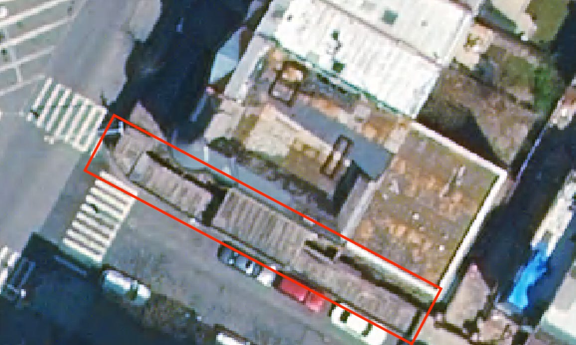
How does all that scaffolding look from space? Bad!

The permits for this block were also strange. Although there were sidewalk shed permits in force for 165 Chrystie throughout its construction, there were only permits issued for 173 Chrystie between 2017 and 2018. It also appears that the Department of Buildings never issued any permits for 167 Chrystie! Moreover, no scaffolding permits for any site on the block have been issued since September 2019, which means all of them expired by September 2020. But hey, if you’ve had scaffolding up for the past six years, what’s another year or two among friends?5
While free, high-res imagery of New York City is only published once every two years, the possibilities of using satellite imagery generally to detect runaway sidewalk sheds and other municipal nuisances are exciting: could machine learning be applied to detect scaffolding in imagery? Could cities use permit data to ensure sidewalk sheds are the correct dimensions and staying up for only as long as they’re permitted for? Could officials overlay local business receipts to show how commerce is impacted by the effect of scaffolds on foot traffic? The possibilities are endless!
Anyway, to paraphrase Reagan:
Mr. DeBlasio, tear down these sheds.
Local Law 11, the rule that regulates many of NYC’s sidewalk sheds, was originally passed to do just this - prevent needless deaths and injuries from things falling off dangerous buildings.
Six inches per pixel!!!!!
Construction was hampered by a Robin Hood-like figure (I joke) stealing power tools from the site


