Nasir Khelo Raid
I’ve done a few relatively long posts recently, so I wanted to return with a fairly simple geolocation. On March 8, Taliban spokesman Zabihullah Mujahid posted a tweet thread claiming that American and Afghan troops raided a property in Nasir Khelo area of Hisarak, Afghanistan. In the course of this raid, the soldiers reportedly killed several civilians, destroyed their homes, and stole their belongings.
Let’s figure out if there is any truth to the Taliban spokesman’s statement. Digging around on Twitter for the locations mentioned in his tweets (Nasir Khelo and Hisarak, specifically), I found a post from the Taliban’s multimedia chief with links to the Taliban’s website. These links contained several versions of videos apparently showing the dead villagers and the area destroyed by the US and Afghan troops.
To avoid giving the Taliban’s website any more clicks than necessary, I also found a version of the video on Twitter, which I’ll use as evidence for the rest of the post.
First things first: let’s find Nasir Khelo village in Afghanistan’s Hisarak district. Luckily, simply Googling “Nasir Khelo Nangarhar” brings up a link to a likely village in the correct district. However, this village contains at least a dozen buildings, and is surrounded by several more unnamed hamlets that could also be considered to be in the Nasir Khelo area. So if this raid did take place, which home or compound did it target?
To answer that question, let’s take a closer look at some moments in the video posted by the Taliban’s multimedia chief.


This screengrab gives a good idea of the landscape we’re looking for when we try to geolocate the targeted compound. If we go back to the satellite imagery of Nasir Khelo village, the valley to the northwest of the village seems to be a prime candidate for the type of landscape seen in the screengrab:

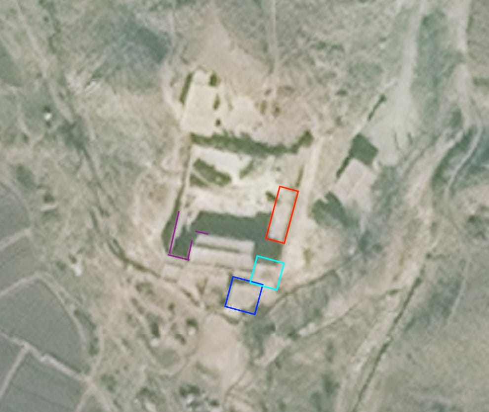
Let’s take a closer look at the compound just to the north of the hedgerows marked in bright green. Could that be the location displayed in the video? Here it is up close:
And here is the same photo marked with a few significant features that also appear in the video:

Let’s start with the right angle in the lower left corner of the compound (marked in purple). The below still from the video shows a decent amount of rubble, but you can still clearly pick out the corner, far wall of the compound, and the masonry that used to make up the left wall of the compound’s front structure. On the far right of the image below, you can also see the remnants of the back wall of the compound’s front structure (the little part marked in purple not connected to the rest of the purple lines).

Vantage Point 1
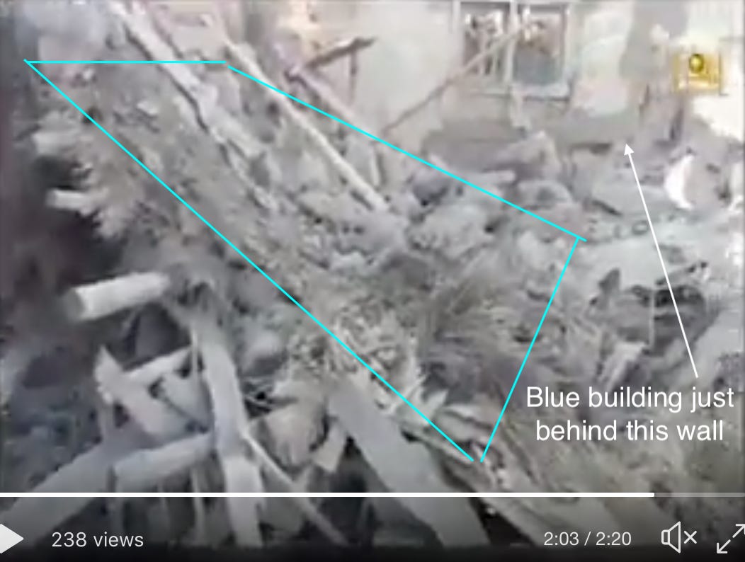
Next, the Taliban video shows two clips (albeit from different vantage points) of the building marked in blue outside the compound’s main walls. In both instances, you can see the landscape around the compound, which further indicates that the compound to the northwest of Nasir Khelo was the one targeted by the raid.
The top image was taken from inside the compound, probably on the rubble of the demolished front building. The bottom image was taken from just outside the compound, looking across the valley at the ridges marked in yellow on the satellite image above.

Vantage Point 2

Vantage Point 3
Finally, the buildings marked in teal and red on the overhead view are only seen from up close in the video. This makes it difficult to get a sense of their shapes but, as the video pans around a bit, you can tell that the red building is a rectangle at the edge of the compound.

Vantage Point 4

Vantage Point 5
To put it all together, here’s the spread of all the vantage points pictured in the screenshots above:

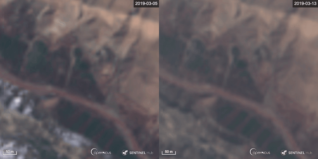
Whew, that was a lot of pictures, arrows, and boxes. But how can we really prove that this was the compound targeted in the raid? Luckily, Sentinel Hub satellites captured good before and after shots of the compound that show that the large front building was completely demolished sometime between March 5 and March 13. Unfortunately, the resolution is atrocious; however, even with the low resolution, it’s easy to tell that the damage in the “after” shot roughly corresponds with the damage to the compound seen in the Taliban video.

(If you’re having trouble seeing it, look for the white, rectangular object on the little ridge just north of the river, about halfway up the image on the right side).
Although we can’t confirm who actually carried out this raid, the before and after satellite images, as well as the geolocations shown above, make it highly likely that the compound to the northwest of Nasir Khelo was the structure that was attacked and destroyed sometime between March 5 and March 13. Though the Taliban could be entirely wrong (or lying) about who carried out the attack and killed the civilians, it does look like there is some truth to the fact that the buildings were destroyed.


