
Fire on the Mountain
Using Sentinel-2 custom scripts to track the Nagorno-Karabakh conflict

Modern war includes any number of “hot” things. And I mean hot literally: spent shells, overheated engines, muzzle blasts, and, of course, the rockets, mortars, bombs, and other munitions endemic to warfare. Nowhere have these elements been more on display recently than in the conflict between Azerbaijan and Armenia over Nagorno-Karabakh.
During the conflict, attention had, understandably, focused on the human cost of the war. The lives ended and upended, the soldiers away from home, the civilians concerned about their livelihoods, the workers out of the economy. However, the environmental cost of the war flew under the radar. While not as significant as the thousands of lives lost in Nagorno-Karabakh, the natural and man-made environments of the region have suffered just as badly.
One way of visualizing and quantifying the toll of these clashes on the environment is through satellite imagery. I partnered with remote sensing expert Pierre Markuse to modify Sentinel-2 satellite imagery with a custom script to display the astonishing damage suffered by the environment since late September in Nagorno-Karabakh. By tracking damage to the environment, we can also determine exactly when and where Azerbaijani forces advanced into Nagorno-Karabakh, as well as identify damaged areas that had not been previously reported.
The code Pierre put together is below, for anyone wishing to replicate the findings:
//VERSION=3
function setup() {
  return {
    input: ["B12","B08","B04", "dataMask"],
    output: { bands: 4 }
  };
}

function evaluatePixel(sample) {
  return [2.7 * sample.B12,2.4 * sample.B08,2.3 * sample.B04, sample.dataMask ];
}
It essentially ingests three bands (B12, B08, and B04), each representing a different sensor on a Sentinel-2 satellite. It then assigns each of the bands a place in the red-green-blue spectrum, based on its position in the “return” statement toward the bottom of the script. B12 is in the red slot, B08 is in the green slot, and B04 is in the blue slot. Finally, it multiplies each of the red-green-blue values by a different number to improve contrast between the three colors in the final image.
Without getting too technical, the B12, B08, and B04 combination uses Sentinel-2’s infrared sensors to display healthy vegetation as shades of green, bare ground and rock as light brown, and burned vegetation as a dark, reddish-brown.
Immediately, I noticed these dark, reddish-brown splotches pop up all over Nagorno-Karabakh in areas that had previously been lush and green.

While I had an inkling that these burn scars may have been due to the conflict, I wasn’t sure. Plus, since I am not an expert in the region by any means, I wanted to validate my findings based on Nathan Ruser’s very good admonition:
To do so, I examined the area outside Tonashen:

Historical imagery shows that the geometric reddish-brown scars on the right are totally normal, even though they appear fairly similar to the craggy reddish-brown scars in the mountain range in the center-left of the image. In this image from September 25th, before the conflict broke out, the geometric brown areas are already there, indicating that they’re probably a result of agriculture or some other benign cause.

Historical imagery also shows that, in the nearby mountain range, the splotches appeared in mid-October (specifically between the October 18th and October 20th images), during the height of the conflict:

Indeed, the Azerbaijani military itself said that there was heavy fighting in the region surrounding Tonashen toward the end of October - confirming that the splotches are not agricultural and instead represent deforestation from the clashes. Using Sentinel Hub’s polygon builder, we can tell that roughly 70 square kilometers of mountain range were deforested in just this one area:

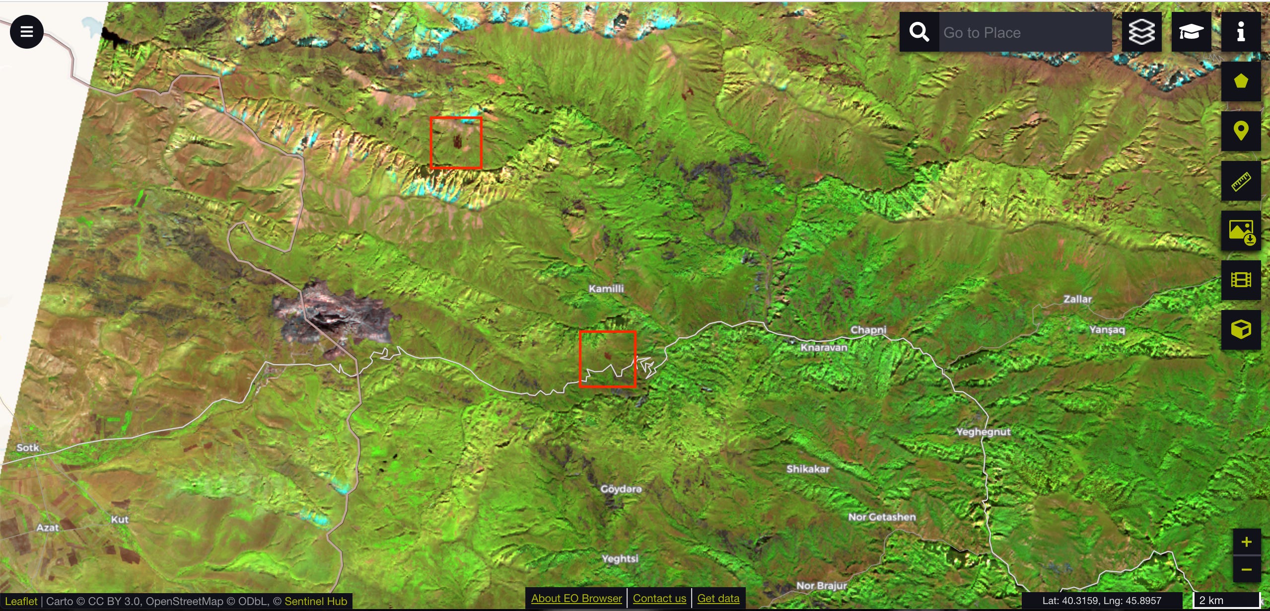
We can also use Sentinel-2 custom scripts to track the path of fighting in the conflict zone. As an example, let’s examine a series of villages in Nagorno-Karabakh near the Sotk Pass, on the border between Nagorno-Karabakh and Armenia proper.
As a baseline, here’s the Sotk Pass on September 18th, 2020 - well before the fighting started - processed using the script above. The vegetation is bright green and the stony mountaintops range from gray to black.

The first burn scars appear on October 15th. The northern one is quite close to a military base or observation post at the center of a small road network - perhaps the target of shelling that caused the fire to break out in the first place. I’m not certain, but I believe the southern scar is an Armenian trench network dug into the hills south of Kamilli.
(You can explore the observation post and roads here and if you want to venture a guess on what the southern burn scar covered, take a look at it here).
On the next image, taken on October 18th, not much has changed. There are a few additional burn scars and the burn scar around the observation post in the previous image has expanded a bit. The scars on the below image are also found near Armenian and Azerbaijani military positions, such as the northernmost one here and the easternmost one here.

Things take a turn for the worse over the next few days. On October 20th, multiple areas in the region were seen on fire. The northernmost box in the image below was the small burn scar near the observation post and road network in the first image - it has clearly expanded dramatically. The trench network and adjacent hills and valleys south of Kamilli are almost totally deforested (not to mention actively on fire). Finally, more splotches appeared south of Yansaq, on the right of the image, indicating ongoing fighting.

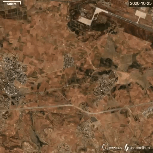
From a remote sensing perspective, very little changed over the following days. Satellite images from October 23rd and October 25th show relatively static burn scars, although the scar south of Kamilli was once again on fire and had expanded slightly by the 25th.
The next image, from October 28th, is interesting because it actually shows the start of several fires. While the burn scars themselves are not extensive, the flames (the tiny orange dots in each box) are visible from space - indicating the severity with which these fires would eventually burn.

Unfortunately, the next image (October 30th, below) is marred by clouds. Despite the cloud cover, the fire boundary south of Chapni is clearly visible. The box on the left is interesting as well because it appears to show a burn scar within undisputed Armenian territory. Although the war was mostly contained to Nagorno-Karabakh, shelling appears to have strayed outside the boundaries and burned land in Armenia proper.

By November 4th, deforestation had exploded. I didn’t even bother adding the red squares because the small fires in the prior two images had expanded so dramatically. The valleys north and south of Chapni were devastated, the trench complex near Kamilli was scorched, and more small splotches had popped up around other military positions in the region.
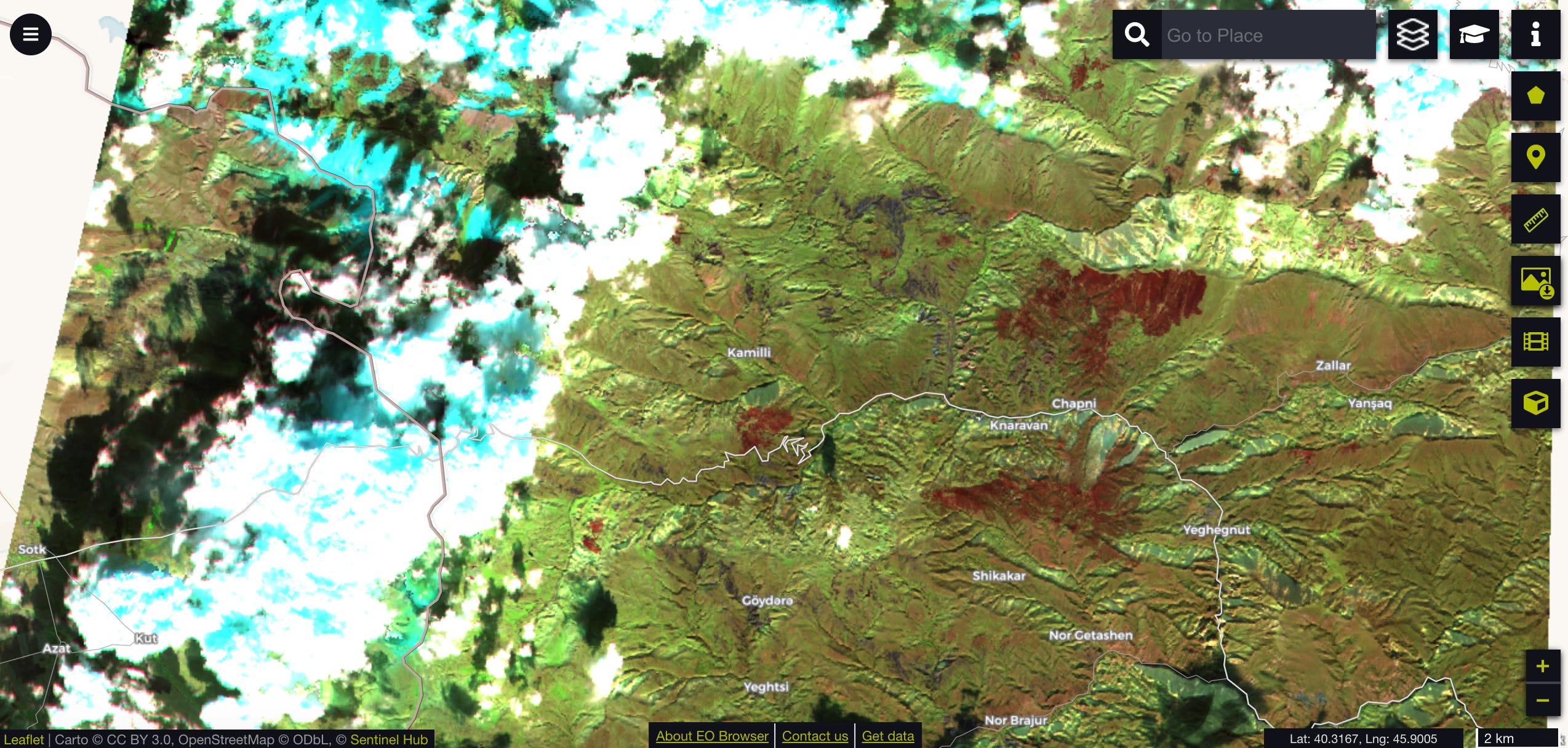
By the November 14th image below, the destruction was complete. Virtually all military positions had been burned, villages had suffered serious damage, and the forests and previously lush valleys were charred ruins. Also note the huge new burn scar west of Kamilli. The scar is located directly over the hamlet of Kholdana, which, judging by the size of the scar, likely experienced a fire that decimated the village.

The aggregate area deforested near the Sotk Pass during the conflict amounts to about 35 square kilometers - more than half the size of Manhattan.
To drive home the extent of the destruction in the region, Pierre processed a series of high-resolution images showing the course of the fighting. The differences from before and after the conflict are stark.

Image from October 18th - before the majority of the fires broke out.

Image from November 14th showing the range of burn scars across the region. (Reach out to Pierre or I if you want the full series)
These fires could have started for any number of reasons - routine shelling, civilians or retreating Armenian forces salting the earth, or even white phosphorous. Whatever the proximate cause of the fires, Sentinel-2 and the platform’s custom script feature have proven to be extremely useful tools for tracking the progress of fighting and evaluating damage to the landscape.
The war between Armenia and Azerbaijan has not only led to the deaths of thousands of soldiers and civilians, but also to the destruction of hundreds of square kilometers of pristine mountains, forests, valleys, and plains. This scorched land, home to many rare and endangered species and used by residents for trade, agriculture, and recreation, will leave an indelible mark on Nagorno-Karabakh’s environment for years to come.