On March 19, social media reports surfaced about an airstrike near the southwestern Somali town of Afgooye. After reading that US troops may have been involved in the strike, I wanted to learn more.
I conducted a thorough review of Somali video, news, and social media sources and found that the strike likely took place between March 17th and 18th. According to social media sources, soldiers killed at least two elderly farmers and kidnapped up to eight others.
The evidence for this strike falls into two categories. First, there is an extended shot of b-roll footage, likely shot by a stringer or local journalist, that was chopped up and sold to various Somali news organizations. Second, a witness to the scene posted a nearly two-minute-long video of the damage caused by the strike on Facebook.
The witness’s video was extremely useful because it provided a comprehensive, 360-degree panorama of the scene. The b-roll helped confirm several details seen in the witness video.
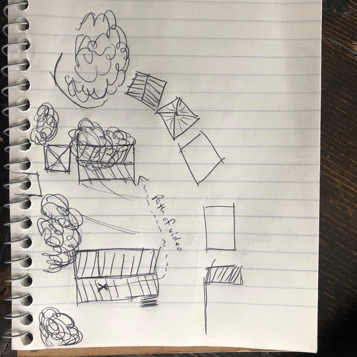
The witness video, shown here, allowed me to put together a hand-drawn diagram of the scene. As it turned out, there would be several errors in my original doodle (blame my artistic skills, or lack thereof), but the basic layout of the area was correct:
Next, I needed to narrow down where, approximately, the strike occurred. After all, Afgooye is situated at the crossroads of several major thoroughfares and contains nearly 100,000 people.
A Facebook post saying that the strike occurred five kilometers from Afgooye helped narrow the range of possible locations significantly. To account for subjectivity in estimating distances, I drew two circles in Google Earth: one with a radius of six kilometers from the center of Afgooye and one with a radius of four kilometers. I figured that the target of the strike, reportedly five kilometers from Afgooye, was most likely in the band between the two circles:

Lastly came the basic open-source legwork of matching the features in the video and the diagram to buildings and villages seen on Google Earth. After an hour or two of searching, I found a possible location - a tiny hamlet nestled between the Shabelle River and a small road that peters out in farmland past Afgooye’s last outlying towns. Even better, the hamlet is just over five kilometers northeast of Afgooye, which places it right where the Facebook source said it would be.
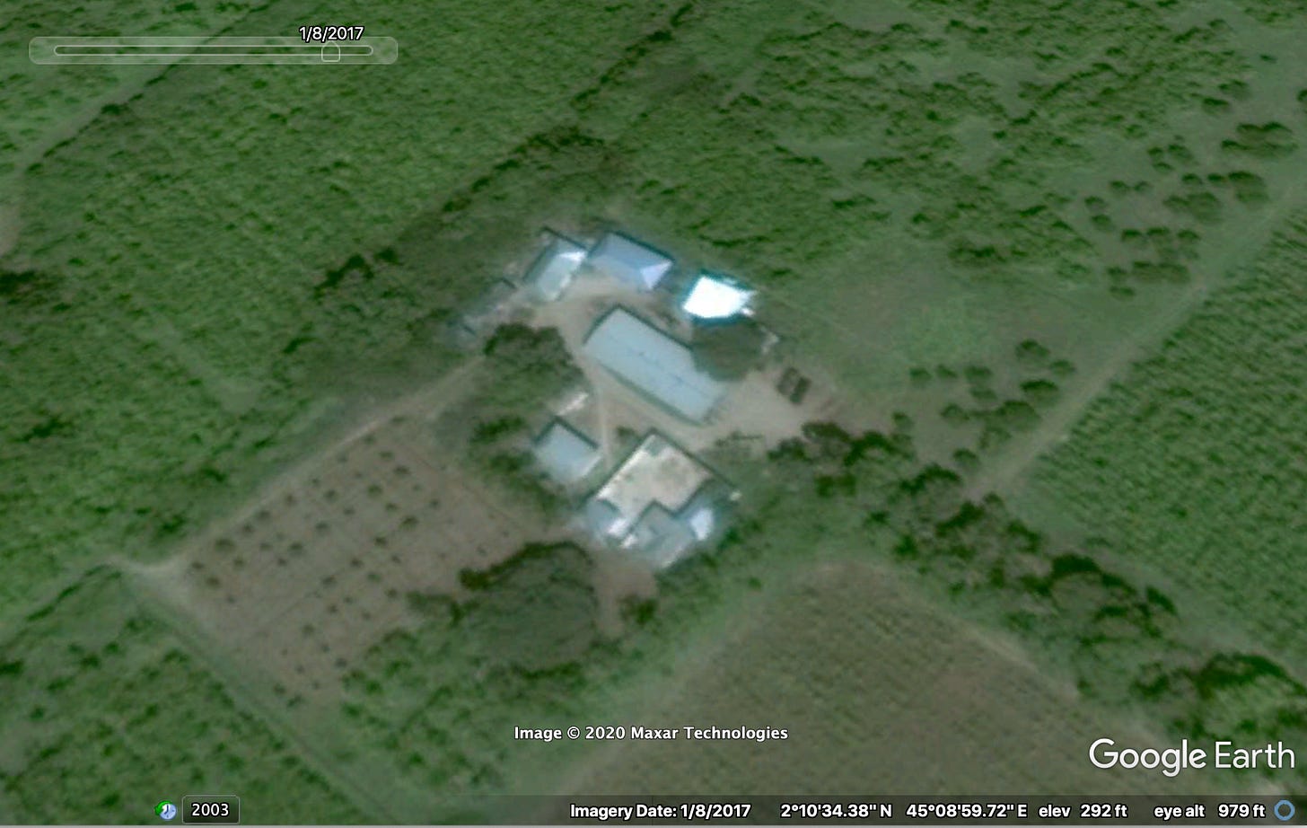
Could this hamlet (coordinates 2.176352, 45.150204) be the location of the strike? Google Earth’s historical imagery and a close examination of the evidence at hand is necessary to confirm this is, in fact, where the assault took place.
First, the large hall in the middle of the hamlet is an exact match with the long, rectangular building under which the majority of the witness video was shot.
Second, there is a row of small buildings on the northwest side of the compound visible in a February 21, 2014 Google Earth shot. If you look closely, that row of buildings is also seen in the witness video:

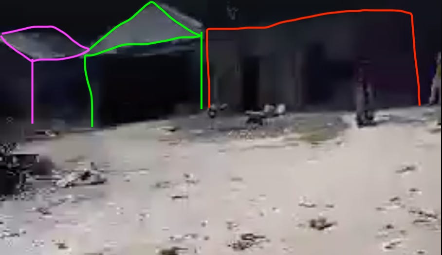
The corresponding row of buildings from space:

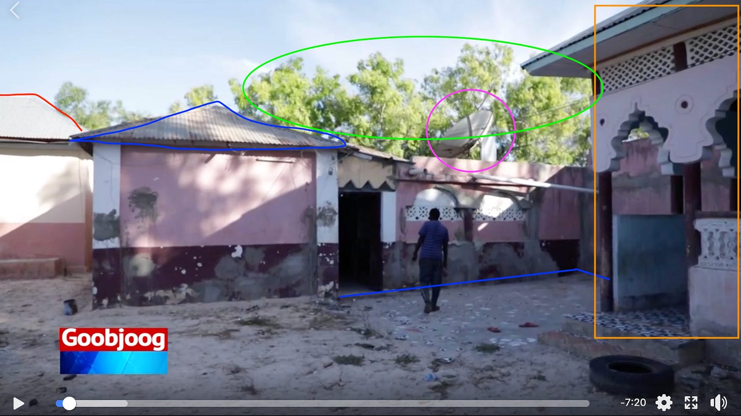
Third, a clip from the b-roll used in a Goobjoog News video shows a section in the south of the compound.

The final (and thorniest) outstanding question is also the most significant: where, in the satellite imagery, is the building near the main hall that appears to be the most demolished structure in the whole compound? The shredded building is seen here behind the blue trailer:

There is a simple, albeit somewhat unsatisfying, explanation. Upon closer examination of the video and the satellite imagery, the building is completely covered by the enormous tree at the western entrance to the compound and therefore does not appear in overhead shots.
The building itself is relatively small and is only slightly longer than the trailers seen in the video. The blue trailer is a FEKON T01R which, according to an enthusiast’s website, clocks in at a robust 3.2m long (10.5 feet). The building appears to be around two trailer lengths, or roughly 21 feet, long. The tree, on the other hand, spans a massive 60 foot diameter, more than enough to hide the building from nosy satellites.
Despite the tree, I confirmed the building’s existence by taking a look at the small white building outlined in aquamarine below:

Did you notice anything about the picture of the blue trailer and the demolished building above? The northeast edge of the thin white building can just be seen peeking out from behind the gigantic tree:
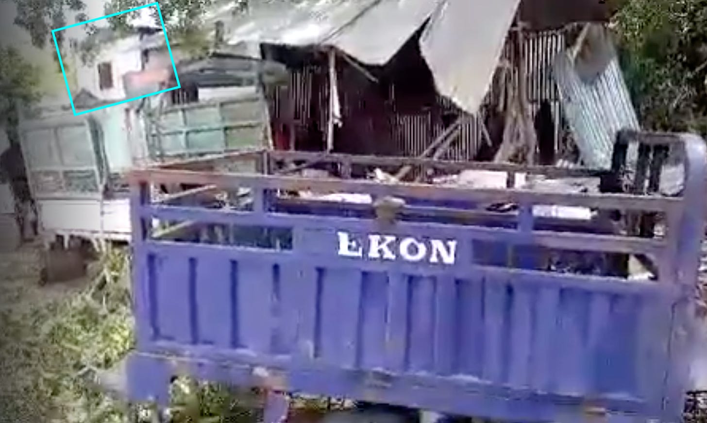
So there you have it: the compound identified above must be Beerta Xassan Huutan, the target of the strike:
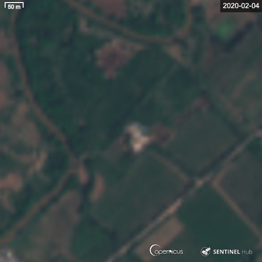
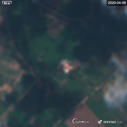
For extra confirmation, look at the Sentinel Hub imagery of the compound from before and after the strike. The hamlet’s large, central hall, which suffered extensive roof damage, has been repaired with a bright red material.
Before:
After:
The earliest evidence we have of the strike is a Facebook post dated March 18 at 1:50pm local time. Therefore, the assault likely (albeit not certainly) occurred sometime between the night of March 17 and the morning of March 18.
Although I could not find any evidence of US forces being involved in the strike (such as leftover munitions or media of soldiers), it is clear that a violent attack targeted the hamlet of Beerta Xassaan Huutaan on or around March 18.
Finally, the allegations of farmers being killed and arrested without charges during this incident are troubling. To that end, I encourage the Somali and US governments to be completely transparent about who, exactly, the casualties and detainees from this raid are.


